
You can import a PNG overlay directly into your OnePlan event site.
This can be particularly useful if you have CAD drawings or additional aerial photography that you might want to use in your event planning. This can be particularly useful if you have drawings of a building where you want to plan the event inside.
PLEASE NOTE: This feature is limited depending on your subscription plan.
If you need to request overlays from a previous OnePlan Classic event, please complete this form.
Here are some further suggestions of how you can use the PNG overlay import.
-
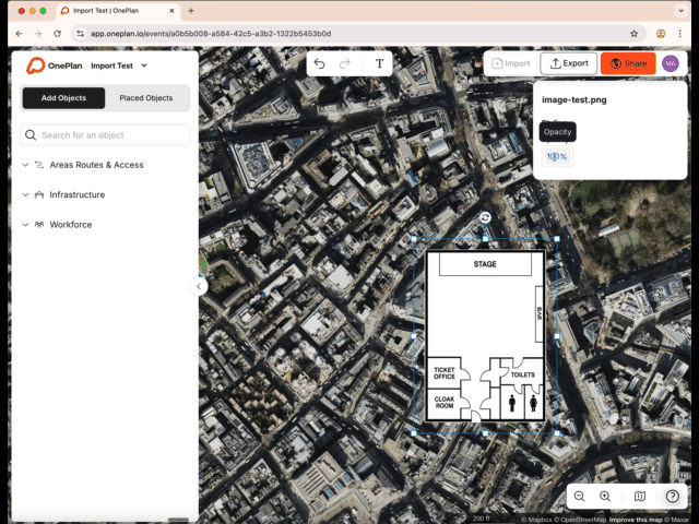
For example a Site Plan layout/ Drone photo that you use as an overlay to then plot objects on top of on the map. A 'site plan layout' can also be a floor plan.
-
For replacing satellite imagery where the imagery is dark/ out of date
-
Using as a layout with a grid on that you want to work off and plot on top of as a map layer alternative.
Adding a PNG file to your plan
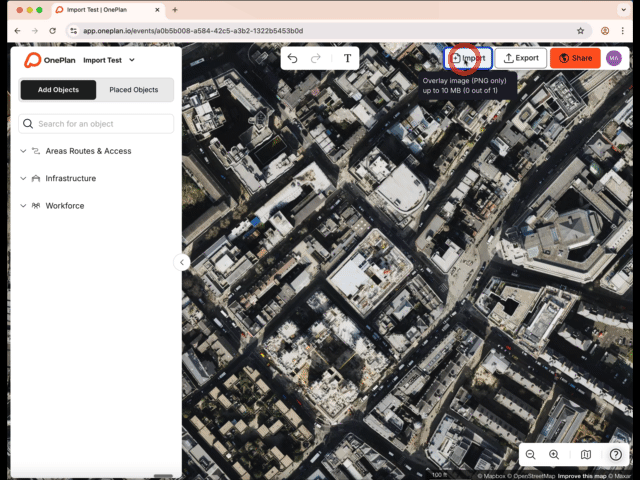
1) Click the import overlay button and choose a file (PNG format only) from your workspace that you want to upload.
(You are limited to a max file size of 10mb for upload with a maximum resoltuion of 10,000 pixels.)
2) Click open and you will see a notification the overlay is uploading.
3) Once your overlay has been uploaded you can;
- Adjust the scale by dragging the nodes
- Rotate the overlay (using the rotate hander)
- Adjust the opacity of the overlay
- Rename your overlay (Via properties panel or placed objects)
- Delete your overlay;
- Show/hide your overlay
- Lock/unlock your overlay
Tips for adjusting your overlay once placed;
-
Choose a fixed reference point to work from- such as a building. This will make the lining up process easier when trying to match the overlay to the map.
-
Adjust the opacity of the overlay to under 85% to help you see the map view underneath for alignment;
-
Make small rotation adjustments- small increments are better than large ones making easier to adjust the overlay to the desired rotation.
-
Lock your overlay (via right click, shortcut or in placed objects) after you’ve finished adjusting the scale so that it doesn’t move and you can then start to plot objects on top of it
*When zoomed in you can use the spacebar to pan around the map when the overlay is locked
How can I move around my map when the overlay is locked?
You can still pan around the map when your overlay is locked and you are zoomed far into the overlay by holding down the spacebar and dragging with your mouse.
Can I copy/paste my import overlay?
No, you are unable to copy or paste your import overlay.
What file types can I import?
Currently, you can only import a PNG file through this method. Other file types such as .shp, geojson, KML, KMZ, DWG, DXF, DWF, .PDF, .JPEG are not supported.
The maximum supported file size is up to 10mb
What if I my file isn’t a PNG? How do I convert my file from a JPEG ready for upload?
You can easily convert your file from a JPEG format to a PNG using a free online converter.
Some recommended sites;
TinyPNG – Compress AVIF, WebP, PNG and JPEG images
JPG to PNG Converter - FreeConvert.com
PDF to PNG – Convert PDF to PNG Online
*Please remember that significantly compressing your files size can impact the quality of resolution of your file.